


Spartan Forge: Hunt
Spartan Forge LLC
I approached Spartan Forge: Hunt as someone trying to turn a vague hunting plan into a more deliberate day outdoors. Its appeal is easy to understand: instead of treating hunting as a collection of disconnected map checks, weather searches, notes, and guesses, it aims to bring those decisions into one sports-focused app. I found that most useful when I already had a specific property, target, or season in mind and wanted help organizing the next move.
This is a free app from Spartan Forge LLC, with optional in-app purchases ranging from $7.99 to $79.99 per item. It is rated for Everyone, runs on Android 7.0 or later, and has built a modest audience of over 50 thousand installs. The current version is 1.18.17. Its average rating sits at 3.6 from around 300 ratings, which feels consistent with my overall impression: the idea is strong, but the experience depends heavily on how much preparation you are willing to do and how well the app fits your personal hunting style.
From a rough hunting idea to a workable plan
My starting condition was the same one many hunters face: I knew the general area I wanted to hunt, but “I will go there and see what happens” was not enough. A useful plan needs more than enthusiasm. I wanted to think about access, likely movement, wind, terrain, timing, and the practical question of whether a promising spot could actually be reached without ruining the setup.
The first important point is that this is not a replacement for field judgment. The app can help structure decisions, but it cannot see a muddy access road, a freshly cut path, a locked gate, or a change in animal behavior that happened that morning. I treated its AI-driven planning approach as a way to create better questions, not as an automatic answer to every question.
That distinction matters because the strongest use case is preparation. Before leaving home, I could use the app to organize a property and think through possible approaches rather than arriving with one favorite location and no backup. A hunter who enjoys studying maps and refining plans will probably get more from it than someone looking for a single button that announces exactly where to sit.
Related News

Why WhatsApp Messenger Still Makes Everyday Communication Feel Easy

Jurassic World: The Game Is the Better Dino Tycoon for Strategic Players

Threads in Real Life: Who Should Join, Lurk, or Leave
How SHEIN Turned Shopping Into an Endless Content Feed
How to Make Fortnite Feel Smarter on Mobile

Should You Switch to Microsoft Outlook on Mobile?
I also found it helpful to begin with a narrow objective. “Plan a deer hunt on this property under these conditions” is a more useful starting point than trying to map every possibility at once. A focused goal makes the information easier to interpret and keeps the planning process from becoming a long tour through layers and settings that do not affect the immediate outing.
Building the first plan instead of chasing every possibility
My practical workflow was to identify the area, inspect the terrain, consider access, and then compare likely options against the day’s conditions. That order sounds simple, but it prevents a common mistake: choosing a visually attractive location before checking whether the route, wind, and timing support it.
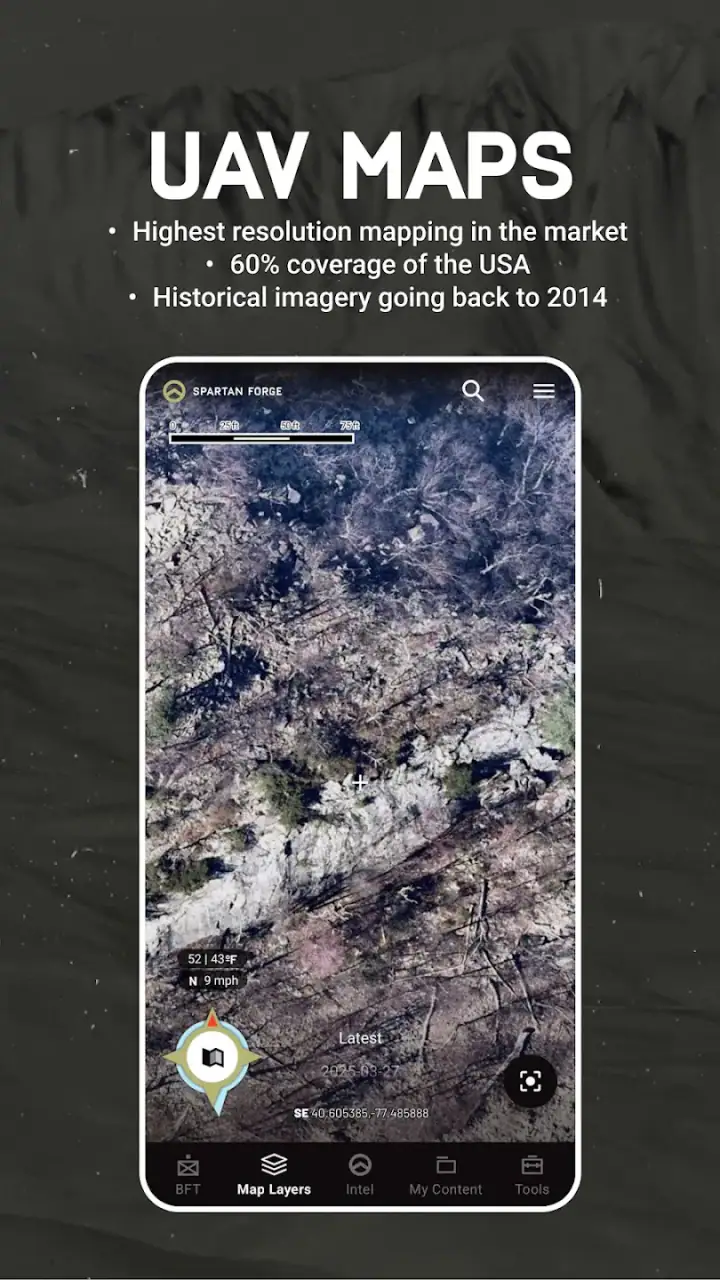
The map is most valuable when I use it as a decision surface rather than just a picture of the property. I looked for ways to approach a location, places where movement might naturally be guided, and positions that offered a reasonable balance between opportunity and disturbance. I would not rely on a map alone to confirm a trail or bedding area, but it helped me decide what deserved attention during a scouting visit.
Gallery
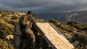
A useful advanced habit is to create a primary plan and a fallback before the hunt begins. If wind or access makes the first option poor, I can shift to the second without improvising under pressure. That is one of the less obvious benefits of an all-in-one planning tool: the backup is made while I am calm, not while I am already dressed, moving quietly, and trying not to waste the morning.
Another trade-off is detail versus speed. I can spend a long time examining possible routes and terrain relationships, but not every hunt deserves that level of analysis. For a familiar property, a quick review may be enough. For unfamiliar ground, public land, or a trip where I have limited time, the deeper planning process becomes more worthwhile.
Turning map work into decisions I can use outdoors
The handoff from the screen to the real world is where many hunting apps become less impressive. A digital plan is only useful if I can remember it, follow it, and adjust it without constantly stopping to re-evaluate everything. I found it best to reduce the plan to a few practical decisions: where I will begin, which route I will take, what conditions would make me change position, and what my exit plan is.
This is also where I would advise new users to avoid overconfidence. An AI-assisted recommendation may highlight a sensible possibility, but it should not override local knowledge. If a route crosses a wet area, passes too close to a known bedding zone, or depends on a wind that changes in the timber, I would alter the plan. The app helps me prepare; my responsibility begins when the plan meets the ground.
For a realistic morning scenario, imagine arriving before daylight with a chosen primary setup and one alternative. The wind is not behaving as expected, and the direct route would carry scent toward the area I want to preserve. Instead of abandoning the outing, I can use the preplanned alternative and approach from a different direction. That handoff from planning to execution is where the app earns its place for me.
The same workflow can help after the hunt. Rather than remembering the day as a general success or failure, I can review what I expected, what actually happened, and which assumption was wrong. Was the access route too noisy? Did the wind shift? Was the location promising on the map but poor in person? That kind of comparison gradually improves the quality of future plans, even when the app itself cannot explain every result.
Where the app fits beside ordinary alternatives
The usual alternative is a combination of a mapping app, a weather app, handwritten notes, saved photographs, and personal memory. That approach can work very well, especially for experienced hunters who already have a system. Separate tools may even be better if I want maximum control over each part of the process or if I dislike having planning decisions gathered into one interface.
The advantage here is continuity. I can begin with the hunting objective, examine the area, consider conditions, and prepare an approach without constantly switching between unrelated tools. That reduces mental friction. I am less likely to forget why I saved a location or lose the connection between a map observation and the decision it was supposed to support.
The disadvantage is that an all-in-one system can feel less transparent than a simple map and notebook. When I draw my own conclusion from raw information, I know exactly why I chose it. When an AI-driven suggestion influences the plan, I need to apply more skepticism and ask whether the recommendation matches what I know about the property. Convenience is valuable, but it should not become blind trust.
For a hunter who spends most outings on one familiar parcel, a basic mapping tool and a well-maintained notebook may be faster. For someone exploring new ground, coordinating several possible setups, or trying to make planning more systematic, this app has a clearer advantage. I would not call it automatically better; I would call it more useful when the planning problem is complicated enough to justify a central workspace.
The handoffs that determine whether the workflow succeeds
The first handoff is from intention to location. I need to define what I am hunting and where I am willing to spend time before the map becomes meaningful. Without that decision, it is easy to browse endlessly and mistake activity for preparation.
The second handoff is from digital terrain to physical access. A route that looks efficient may not be quiet, legal, safe, or practical. I would verify boundaries and access conditions independently and treat every suggested route as a starting point. This is especially important when moving through unfamiliar land or when the cost of a mistake is disturbing the very area I planned to hunt.
The third handoff is from a general recommendation to a personal choice. The app may help surface a promising option, but I still have to decide whether it fits my equipment, fitness, timing, wind tolerance, and experience. A theoretically strong location can be the wrong choice if reaching it requires a noisy approach or leaves no sensible way to leave.
The fourth handoff is from the day’s result back into future planning. I get more value when I record observations and compare them with the original plan. Even a blank day can provide useful information if I know what I expected and what changed. That feedback loop is more important than any single recommendation because hunting conditions are variable and no map can remove that uncertainty.
What I would prepare before paying for anything
Because the app is free to start but includes optional purchases, I would spend time learning the basic workflow before deciding whether an upgrade is worthwhile for me. The right question is not simply whether paid tools exist; it is whether they improve the specific part of my process that currently causes trouble.
I would begin with one property and one planned outing. I would test how quickly I can find the area, interpret the map, compare possible approaches, and return to the plan later. If those steps already feel natural, I can judge whether additional functionality would save meaningful time. If the basic navigation or organization feels awkward, paying for more capability will not solve the underlying friction.
I would also keep a separate backup of important notes and access information. An app can be the center of my preparation without being the only place where I remember critical details. A short written plan, offline reference, or familiar map backup can make the outdoor handoff less stressful, particularly when I am working in a location where attention should stay on safety and surroundings rather than on a phone.
That is not a criticism unique to this product; it is a sensible habit for any digital hunting workflow. The more I depend on a screen for planning, the more important it becomes to know the plan well enough that I can execute its essential parts without repeatedly checking it.
Where the flow breaks down
The biggest break occurs when the app’s planning logic is treated as certainty. Hunting is full of variables that do not fit neatly into a digital model. Recent pressure, changing food sources, human activity, noise, weather shifts, and animal behavior can all invalidate a reasonable-looking setup. I found the tool more trustworthy when I used it to rank possibilities and prepare alternatives rather than predict an outcome.
Another weak point is the learning curve created by having many planning ideas in one place. A newcomer may open the app expecting immediate clarity and instead face a process that rewards careful exploration. That is not necessarily a flaw, but it means the first session may feel more like setup than instant utility. I would not recommend judging it after a few minutes of casual browsing.
There is also a practical limitation for hunters who prefer minimal technology. If your normal method is a paper map, a compass, and years of local knowledge, this may add more screen time than value. The app is not the right choice simply because it uses AI. It is the right choice when its planning structure genuinely improves how you prepare, compare options, and adapt.
The rating of 3.6 reflects why expectations should be realistic. This is a specialized tool with a particular workflow, not a universally effortless sports app. Some users will appreciate the concentration of planning resources, while others may find the interface, recommendations, or paid boundaries less comfortable than their existing routine.
Who should use it, and who should skip it
I would recommend giving it a serious trial if you hunt unfamiliar properties, like building backup plans, or often feel that your preparation is scattered across too many tools. It is also a good fit for someone who wants to become more deliberate about the connection between terrain, access, conditions, and execution rather than making every decision after arriving.
I would be more cautious if you only need a basic map, already have a reliable system, or strongly prefer to make every interpretation yourself. In those cases, a simpler alternative may be quicker and easier to trust. I would also skip it as a primary decision-maker if I were unwilling to verify digital suggestions in the field.
For me, the best result comes from treating the app as a planning partner, not a guide that takes responsibility away from me. I can use it to prepare a primary route, identify a fallback, organize my thinking, and review what happened afterward. The outcome is not guaranteed success; it is a clearer process with fewer avoidable decisions left to chance.
My final view is that Spartan Forge: Hunt is most valuable before the hunt begins. It brings structure to a complicated preparation process and can make the handoff from map study to field execution more intentional. Its limitations are real: it asks for patience, judgment, and a willingness to verify what the screen suggests. But if you want an AI-assisted hunting planner rather than another basic map, and you are prepared to use its recommendations thoughtfully, I think it is worth exploring as a free starting point.
After using it, I would keep the workflow simple: define the outing, study the property, create one primary and one backup plan, verify both on the ground, and record what the day taught you. That approach lets the app contribute where it is strongest while leaving the final decisions where they belong—with the hunter.
FAQs for Spartan Forge: Hunt
What is Spartan Forge: Hunt, and who is it designed for?
Spartan Forge: Hunt is a hunting-focused mobile app designed to help hunters plan, scout, and make more informed decisions in the field. It combines mapping tools, property information, weather data, terrain details, and predictive insights in one platform. It is most useful for whitetail hunters, although the available tools may also benefit people pursuing other game or exploring unfamiliar hunting areas.
Does Spartan Forge: Hunt require an internet connection to work?
An internet connection is generally needed to download maps, update weather information, access property data, and use cloud-based features. However, the app is intended for outdoor use, where cellular coverage may be unreliable, so hunters should prepare their maps and relevant information before leaving home. Offline availability and the exact features supported without service can depend on the selected subscription and app version.
What information and tools does Spartan Forge: Hunt provide?
The app brings together several tools intended to support hunting preparation, including interactive maps, terrain and property boundaries, weather conditions, wind information, and location-based planning features. Its predictive or analytical tools are designed to help users evaluate likely animal movement and choose promising areas. The usefulness of these recommendations still depends on accurate data, local conditions, and the hunter’s own experience.
Is Spartan Forge: Hunt free to download, or does it require a subscription?
Spartan Forge: Hunt may be available to download without an upfront charge, but some of its more advanced mapping, data, forecasting, or planning features can require a paid subscription or in-app purchase. Before committing, review the current pricing, trial terms, renewal policy, and included features in the Google Play Store or Apple App Store. Availability and subscription options may vary by platform or region.
Can Spartan Forge: Hunt replace scouting, maps, or knowledge of local hunting regulations?
No. Spartan Forge: Hunt should be treated as a planning and decision-support tool rather than a replacement for physical scouting, navigation skills, paper maps, landowner permission, or official regulations. Predictions can be useful, but they are not guarantees, and conditions can change quickly in the field. Always verify boundaries, seasons, licenses, access rules, and safety requirements through official local sources before hunting.
Pros
- Detailed hunting maps with terrain
- public land
- and access information.
- Weather and wind forecasts help plan hunts more effectively.
- AI-powered insights can suggest promising hunting locations.
- Useful tools for tracking waypoints
- sightings
- and hunting activity.
- Supports more strategic preparation for different hunting conditions.
Cons
- Many advanced features require a paid subscription.
- Map data and forecasts may vary in accuracy by location.
- The app can feel overwhelming for first-time users.
- Some features depend on a reliable internet or GPS connection.
- Frequent location tracking may increase battery consumption.


